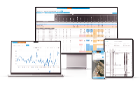
The Best Alternative to EQuIS for Environmental Data Management & Compliance Monitoring: A faster, browser-based, no-code environmental data management system.
ESdat is a specialized environmental data management, analysis, and reporting platform developed by EarthScience Information Systems (EScIS). Designed for environmental scientists, geologists, hydrogeologists, engineers and compliance professionals, the software provides a centralized system for managing the large and varied datasets generated by site investigations, monitoring programs and environmental operations.
The platform brings together information from analytical laboratories, field sampling programs, borehole investigations, data loggers, sensors, historical records and regulatory standards. By consolidating these sources in a structured database, ESdat helps organizations replace fragmented spreadsheets and manual data-handling processes with consistent, traceable workflows. Data can be validated during import, reviewed through approval processes and followed back to its source, supporting quality assurance and the preparation of defensible technical and regulatory reports.
ESdat includes direct laboratory-data integration, allowing supported laboratories to submit analytical results electronically. Incoming data is checked for formatting and validation issues before being loaded into the system, reducing repetitive data entry and the risk of transcription errors. Historical chemistry, monitoring-location, well, geological and other project data can also be imported from spreadsheets and databases through bulk migration tools.
Field programs can be planned and managed within the platform. Users can define monitoring locations, required samples, analytical suites, field measurements and recurring schedules before assigning work to field personnel. The ESdat Field App supports offline collection of observations, photographs, water levels, field parameters, stabilization measurements and other configurable information. Collected data can be synchronized with the central system once a connection becomes available, enabling office-based teams to monitor progress and review results.
For geotechnical and geoenvironmental applications, ESdat can store borehole, geological and groundwater information and produce report-ready bore logs. It can also incorporate continuous measurements from environmental data loggers and sensors, including water-level, water-quality, meteorological and dust-monitoring instruments.
Analysis and reporting tools include configurable dashboards, chemistry summary and exceedance tables, time-series graphs, statistical summaries, trend analysis and map-based data exploration. Analytical results can be compared with preloaded environmental guidelines, site-specific trigger values, license conditions or user-defined standards. Notifications can alert users to exceedances, overdue laboratory reports and upcoming or missed monitoring events. Quality-control tools support assessments such as holding-time compliance, relative percentage differences, blank contamination and ionic balance.
Its mapping interface allows users to view monitoring locations and results against satellite imagery, web mapping services or organizational basemaps. Data can be filtered geographically and exported for use in GIS applications. ESdat also connects with tools such as Microsoft Excel, Power BI and ArcGIS, while APIs and data feeds support integration with wider organizational reporting and information systems.
Selected, approved results can be shared with clients, regulators, project partners or the public through controlled access and customizable public portals. Permissions can be configured so that different stakeholders can view, add or edit information for specified sites and projects.
ESdat is suitable for environmental consulting, contaminated-site assessment, mining, industrial operations, landfill management, government programs and groundwater monitoring. Its principal value lies in connecting data collection, validation, analysis, visualization and reporting within a single environmental information platform. This enables technical teams to spend less time compiling and checking data and more time interpreting results, identifying trends and making informed environmental decisions.